West Africa
Geophysics Laboratory
Unlocking Africa's subsurface for sustainable development through cutting-edge research, innovation, and capacity building.
Featured Project: TIDEKIT
Coastal Early Warning Systems
Impact Dashboard
Tracking our progress and achievements in advancing geophysical research across West Africa
Latest Updates
New Coastal Project
Launch of coastal erosion research in Keta with ONR-Global funding.
Conference Presentation
Presented at Ocean Sciences Meeting 2026 in Glasgow.
New Partnership
Collaboration with Carnegie African Diaspora Fellowship Program.
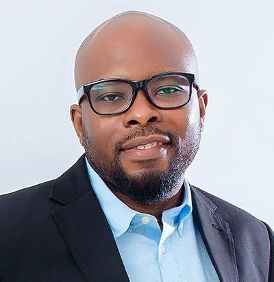
Dr. Cyril Dziedzorm Boateng
Principal Investigator & Scientific Director
West African Geophysics Laboratory
Welcome to the West Africa Geophysics (WAGeo) Lab
Beneath our feet lies a world of untapped potential: resources that could power our communities, water that could sustain our agriculture, and knowledge that could protect our infrastructure.
At WAGeo Lab, we believe that understanding Africa's subsurface is key to unlocking solutions for Africa's development challenges. Our continent faces unique opportunities and obstacles: from discovering and managing our mineral wealth sustainably, to finding reliable groundwater sources in changing climates, to building infrastructure that can withstand natural hazards.
These aren't just scientific questions, they're questions about our future prosperity, resilience, and self-determination. That's why we've established this laboratory at KNUST: to build world-class geophysics research capacity right here in West Africa, where it's needed most.
We're committed to training the next generation of African geoscientists, fostering collaborations across our region and beyond, and ensuring that our research translates into real benefits for our communities.
Let's explore Africa's subsurface together, for Africa's future.
Our Vision
To become a center of excellence in geophysics research and education, driving sustainable development and natural resource management in West Africa.
Our Mission
To advance geophysical research in West Africa, fostering collaboration between universities, industry partners, and government agencies to address regional challenges.
Our Approach
- Research Excellence & Impact
- Capacity Building & Training
- Policy Engagement
- Strategic Partnerships
Partners & Funders
We take pride in collaborating with world-leading academic and governmental institutions to advance geophysical research.
"We welcome new partnerships with research institutions, industry partners, and funding organizations interested in advancing geophysical research in West Africa."
Ready to Explore Africa's Subsurface With Us?
Join our community of researchers, students, and partners in advancing geophysical research for sustainable development in West Africa.
Our Research
WAGeo Lab focuses on geophysical research that addresses the most pressing challenges facing Ghana and West Africa.
Research Focus Areas
WAGeo Lab's work spans four interconnected areas critical to sustainable development in West Africa
Forensic & Archaeological Geophysics
Geophysical methods can reveal what's hidden beneath the surface without disturbing the ground. We're pioneering the application of non-invasive techniques for forensic investigations and archaeological discoveries in West Africa, providing new tools for uncovering our region's history and supporting criminal justice efforts.
Groundwater Resources & Protection
Access to clean, reliable water is fundamental to community health and agricultural productivity. We use cutting-edge geophysical methods combined with GIS, hydrogeochemistry, and artificial intelligence to locate groundwater sources and detect contamination. Our research helps communities and policymakers make informed decisions about sustainable water management.
Energy Resource Exploration
Africa's energy future depends on developing our hydrocarbon resources responsibly and building local expertise. Our research advances exploration techniques while training West African geoscientists to lead these efforts. We tackle the unique geological challenges of our region and work to ensure that resource development benefits our communities directly.
Geohazards & Seismological Research
From coastal erosion to earthquake risks, natural hazards pose real threats to lives, infrastructure, and economic development. WAGeo Lab contributes essential data and analysis for disaster preparedness, helping Ghana and neighboring countries understand and mitigate risks. Our work supports national emergency planning and builds resilience in vulnerable communities.
Research Projects
Our current and completed research projects addressing critical challenges in West Africa
Office of Naval Research-Global
US DEVCOM
US Army Corps of Engineers
Protecting the Coast and Heritage of Keta Using Integrated Geophysical Methods
Ghana's coastal region, home to 25% of the population and 70% of industries, faces severe coastal erosion and flooding. Keta is particularly affected, with over 35% of coastal land lost to erosion, threatening lives, ecosystems, and UNESCO heritage sites like Fort Prinzenstein. This project employs a multidisciplinary approach combining historical data analysis, satellite imagery, geophysical surveys, and early warning systems to manage coastal erosion.
The project's four-part approach includes: 1) Coastal erosion hazard assessment using remote sensing and GIS; 2) Subsurface investigation of erosion processes; 3) Development of low-cost tidal measurement systems; and 4) Creation of a mobile-based tidal wave early warning system. Expected outcomes include machine learning algorithms for erosion prediction, low-cost instrumentation, and trained graduate students.
International Development Research Centre
(RAINCA Consortium)
RAGA: An Artificial Intelligence Based System for Predicting Groundwater Availability
Addressing climate change impacts on water resources, this project develops an innovative web-based AI framework for predicting groundwater availability in Ghana. The system integrates spatio-temporal hydrogeological and climate data to create an open-source application for stakeholders and the public.
The project builds a comprehensive database, develops AI algorithms for data integration and prediction, and creates user-friendly tools for groundwater assessment. Outcomes include responsible AI innovation for climate action, increased African research contributions to international AI policy, and capacity building through training of students and water practitioners.
STIAS Iso Lomso Fellowship
Geophysical Fingerprinting of African Archaeological Sites
Developing a Multi-Method Framework for Characterizing Historical Clay and Mud Structures
This project addresses the challenge of distinguishing between natural soil formations and anthropogenic structures in African archaeological sites, where traditional architecture predominantly used clay and mud-based materials. The research combines laboratory experimentation with field investigations using ground-penetrating radar, electrical resistivity tomography, and magnetic gradiometry.
Through controlled laboratory experiments, the project characterizes the physical properties of traditional building materials under various conditions. The three-year project will deliver a comprehensive database of geophysical signatures, standardized protocols for archaeological surveys, and train a new generation of African scholars in advanced geophysical techniques.
Carnegie African Diaspora
Fellowship Program (CADFP)
Geomodelling a Coastal Community in Ghana to Generate Place-Based Insight and Solutions for Climate Induced Erosion
This project addresses escalating coastal erosion in Ghanaian communities by integrating indigenous knowledge with scientific approaches using high-resolution data and advanced geospatial technologies (GeoAI, 3D/4D geovisualization, drone imagery).
The project aims to: 1) Develop a detailed geomodel of a coastal community to understand and predict erosion patterns; and 2) Empower local stakeholders, including KNUST faculty, students, and community members, with the skills and tools to utilize and maintain this geomodel for informed decision-making and coastal resilience.
UNESCO-TWAS
German BMBF (SG-NAPI)
Digging Deep into Ghana's Slavery Heritage
This project systematically investigates sites associated with the trans-Atlantic slave trade in Ghana using state-of-the-art geophysical methods to uncover material relics and locate traces of the trade. While coastal forts and castles are well-documented, this project focuses on under-studied hinterland sites.
The research involves building rock-like specimens for Ground Penetrating Radar testing and generating synthetic numerical subsurface models for comparison with field data. The project addresses multiple Sustainable Development Goals, trains students, and contributes to international archaeo-geophysical studies, promoting greater understanding of Ghana's slave trade history.
SEG Foundation
Geophysical Studies of Suevite Deposits in the Bosumtwi Impact Crater
This project advances planetary geophysics while promoting awareness among local researchers and aspiring geoscientists about the Bosumtwi Crater's scientific importance.
Specific objectives include: 1) Mapping subsurface structure of suevite deposits to understand impact cratering processes; 2) Training and mentoring students and early-career researchers in West Africa; and 3) Enhancing public awareness through outreach activities about the crater's scientific and cultural significance.
SEG Foundation
Investigating the Slave Trade in Southeastern Ghana Using Integrated Geophysical Techniques
This project advances geophysics and geoarchaeology while training a new generation of geoscientists through investigations of slavery-related archaeological sites in southeastern Ghana's Three Town area.
The project has two main goals: 1) Training geoscience students in the complete scientific process of geophysical investigations; and 2) Delineating anthropogenic traces to enhance geoarchaeological revelations of the slave trade for scientific excavations.
News & Events
Stay updated with the latest developments, announcements, and events from WAGeo Lab
Upcoming Events
Geophysics Workshop 2025
Advanced techniques in subsurface imaging
Student Research Symposium
Showcasing graduate research projects
Publications
Peer-reviewed articles and conference presentations from WAGeo Lab researchers
Peer-Reviewed Articles
A systematic review of machine learning models for groundwater level prediction
Gilbert Jesse, Cyril D. Boateng, Jeffrey N.A. Aryee, Marian A. Osei, David D. Wemegah, Solomon S.R. Gidigasu, Akyana Britwum, Samuel K. Afful, Haoulata Touré, Vera Mensah and Prinsca Owusu-Afriyie
View PaperShoreline change detection along the eastern coast of Ghana: leveraging GIS and advanced remote sensing techniques
Asare-Bediako B., F. Awafu, E. Y. Boakye, E. Boahen, C. D. Boateng, David D. Wemegah, Akyana Britwum, Michael K. E. Donkor, Jeffrey N. A. Aryee, Emmanuel K. Brempong and Leonard K. Amekudzi
View PaperA systematic review of neural network applications for groundwater level prediction
Afful S. K., C. D. Boateng, E. Ahene, J. N. A. Aryee, D. D. Wemegah, S. S. R. Gidigasu, A. Britwum, M. A. Osei, J. Gilbert, H. Touré and V. Mensah
View PaperReview of machine learning algorithms used in groundwater availability studies in Africa: analysis of geological and climate input variables
Haoulata Touré, Cyril D. Boateng, Solomon S. R. Gidigasu, David D. Wemegah, Vera Mensah, Jeffrey N. A. Aryee, Marian A. Osei, Jesse Gilbert and Samuel K. Afful
View PaperKNUST SEG Geophysics Field Camp: A project to study slavery-related archaeology in West Africa
Boateng C. D., D. D. Wemegah, W. Apoh, V. A. Sarpong, J. O. Akingbade, A. A. Aning and T. Dwomoh
View PaperSeismic facies analysis using machine learning techniques: a review and case study
Owusu B. A., C. D. Boateng, V. S. Asare, S. K. Danuor, C. D. Adenutsi, and J. A. Quaye
View PaperAutomatic lithology identification in meteorite impact craters using machine learning algorithms
Yirenkyi S., C. D. Boateng, E. Ahene, S. K. Danuor
View PaperSeismic activities in Ghana: A systematic review
Asare-Bediako B., C. D. Boateng, N. Opoku, S. K. Danuor, L. N.B. Arthur, Y. M. Anokwa
View PaperUnderrepresentation of Local Researchers in Geophysical Studies at the Bosumtwi Impact Crater: Insights from A Systematic Review
Boateng C. D., C. A. Akurugu, D. D. Wemegah, S. K. Danuor
View PaperConference Presentations
Multi-Scale Assessment of Coastal Morphodynamics on Ghana's Eastern Shoreline Using Remote Sensing and Geophysical Data
Asare-Bediako, B., and C. Boateng
Application of Electrical Resistivity Tomography to Locate Archaeological Relics at Fort Tantumquery in Ghana, West Africa
Asiedu D. Y. and C. D. Boateng
Integrating remote sensing and electrical resistivity for assessing coastal dynamics and saltwater intrusion along the eastern coast of Ghana
Boateng C. D., B. Asare-Bediako, E. Hovor, T. Dwomoh and D. D. Wemegah
Integrating multi-method geophysical prospection and UAV data for uncovering British colonial history in Ghana
Boateng C. D., S. Amenyo-Xa, D. Asiedu, M. Muhammed, T. Dwomoh, G. Agyare, K. Atsutse and A. Britwum
Integrating Satellite Remote Sensing, UAV and Geophysics to Monitor Coastal Change Along the Eastern Coast of Ghana
Asare-Bediako, B. and C. D. Boateng
Spatiotemporal Analysis of Coastal Erosion and Accretion Patterns in the Keta Region
Asare-Bediako, B. and C. Boateng
Temporal and spatial changes in the Keta littoral zone, Ghana: A remote sensing approach
Asare-Bediako B., C. D. Boateng, F. Awafu, E. Y. Boakye, and E. Boahen
Uncovering Hidden Histories Through a Field Camp: Geophysical Surveys for Archaeological Investigations of Slavery in Ghana
Boateng C. D. and D. D. Wemegah
View All Conference Presentations
Complete list of 23 conference presentations
All Conference Presentations
Complete list of all conference presentations with authors, dates, and venues.
Our Team
Meet the researchers and staff driving innovation at WAGeo Lab
PI and Head of Lab

Dr. Cyril Dziedzorm Boateng
Principal Investigator & Scientific Director
The PI & Scientific Director is responsible for the overall leadership, strategic direction, and management of the lab. This role includes overseeing research activities, managing collaborations, and ensuring the lab meets its objectives.
PhD Researchers
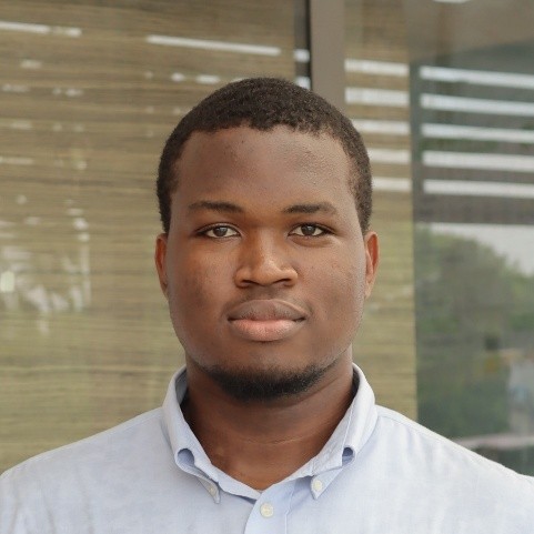
Steven Yirenkyi
Steven Yirenkyi is a PhD candidate in Computer Science at Kwame Nkrumah University of Science and Technology. As an early career researcher, Steven is passionately exploring the application of Artificial Intelligence across various domains. His research interests include machine learning and data analytics, with a specific focus on developing innovative solutions to complex real-world problems, particularly AI for lithology classification in impact craters.
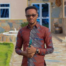
Victor Adutwum
Adutwum Victor is a doctoral researcher and hardware/software engineer in the Department of Physics at KNUST. He holds a BSc in Physics (Electronics) with First Class Honors and an MPhil in Solid State Physics. His doctoral research focuses on developing a low-cost Integrated Coastal Monitoring System using GNSS-IR and Lidar technology for real-time sea level measurement along Ghana's coast. He serves as a consultant for Ghana's National Junior Science and Mathematics Quiz and works as a freelance software and hardware engineer.
Samuel Koranteng Afful
Samuel Koranteng Afful is a PhD candidate in the Department of Computer Science at KNUST. He is also a research assistant in the Department of Meteorology and Climate Science and the physics department, where he applies deep learning techniques to predict weather extremes. His MPhil work focused on using deep learning to predict groundwater yield, and his work has been featured in the WMO Bulletin, highlighting his contributions to weather prediction using deep learning techniques.
MPhil Researchers (Geophysics)
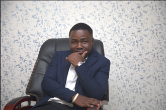
Baah Asare-Bediako
Baah Asare-Bediako is an MPhil researcher in Geophysics at KNUST. His research focuses on the application of remote sensing, GIS, and geophysical techniques to coastal processes, particularly shoreline change analysis, coastal erosion, and beach volume dynamics. He integrates multi-temporal satellite data, UAV-derived products, and geospatial analysis to assess coastal vulnerability and the impacts of coastal protection structures.
Dorcas Yeboah Asiedu
MPhil researcher in Geophysics at KNUST.
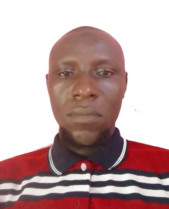
Bukari Nakpari Musah Nairey
Bukari Nakpari Musah Nairey is a dedicated teacher of physics at STEM SHS Kpasenkpe, Ghana. He holds a Diploma in Basic Education and a BSc in Geophysics from KNUST. Currently pursuing an MPhil in Geophysics at KNUST, his research focuses on forensic geophysics, applying geophysical methods to aid investigations and justice.
Eric Hovor
MPhil researcher in Geophysics at KNUST.
Alhassan Mutalabi
Alhassan Mutalabi is a geophysicist with expertise in geophysical methods. He holds a BSc in Physics with Geophysics specialization and an MPhil in Geophysics from KNUST. His MPhil research was on "Digging Deep into Ghana's Slavery Heritage" funded under the UNESCO–TWAS SG-NAPI program. He has worked on the TIDKIT saltwater intrusion study and DANIDA-supported groundwater mapping in Owabi.
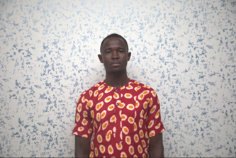
Bana Ballu Fuseini
Bana Ballu Fuseini is an emerging geophysicist and educator pursuing an MPhil in Geophysics at KNUST. His research focuses on forensic geophysics, specifically a controlled Ground Penetrating Radar study on swine burials, the first of its kind in Africa. He holds a bachelor's degree in Geophysics with experience in archaeological applications and is a member of the SEG KNUST Chapter.
Thomas Dwomoh
Thomas Dwomoh is the Principal Technician of the Geophysics Laboratory at KNUST. He holds a Higher National Diploma in Electrical Engineering and a Bachelor's degree in Information Technology, and is currently pursuing an MPhil in Geophysics. He specializes in the operation, maintenance, and application of geophysical instrumentation including ABEM resistivity terrameters, seismographs, GPR systems, and magnetometers.
MPhil Researchers (Meteorology & Climate Science)
Seyram Millicent Krah
Millicent Seyram Krah is a researcher in Meteorology and Climate Science with a focus on interdisciplinary approaches to climate change and environmental sustainability. She holds an MPhil in Meteorology and Climate Science from KNUST. Her research interests include extreme weather events, climate data analysis and visualization, impact-based forecasting, climate variability, coastal meteorology, and the climate–health–agriculture nexus.
Emmanuel Annor Gyimah
Emmanuel Gyimah Annor is an atmospheric and oceanic science researcher whose work focuses on tropical ocean–atmosphere interactions, coastal upwelling dynamics, and climate variability in the Gulf of Guinea. He holds a BSc and MPhil in Meteorology and Climate Science from KNUST. His MPhil thesis examined the coupled atmospheric and oceanic drivers of coastal upwelling near Keta using reanalysis, satellite, and ocean circulation datasets.
Jesse Gilbert
MPhil researcher in Meteorology and Climate Science at KNUST.
Undergraduate Researchers
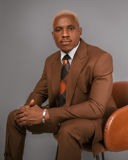
Courage Kwame Letsa
Courage Kwame Letsa is a researcher with the West Africa Geophysics (WAGeo) Lab at KNUST. His work focuses on seismic modeling, ambient noise analysis, and the application of deep learning to earthquake detection and characterization. He has contributed to broadband seismic studies across Ghana, Cameroon, and Uganda, with an emphasis on imaging crustal structure and improving regional earthquake monitoring.
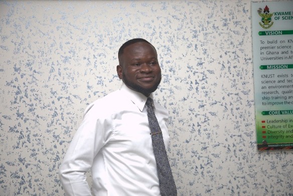
Evans Yiadom Boakye
Evans Yiadom Boakye graduated from KNUST with a BSc in Physics specializing in Geophysics. He joined the lab as an undergraduate intern and later served as an undergraduate researcher under the TIDEKIT project, contributing to mapping erosion hotspots in Keta, Ghana. He has worked as a Teaching and Research Assistant in the Department of Physics while continuing research in the lab, employing UAVs for time-lapse coastal monitoring.
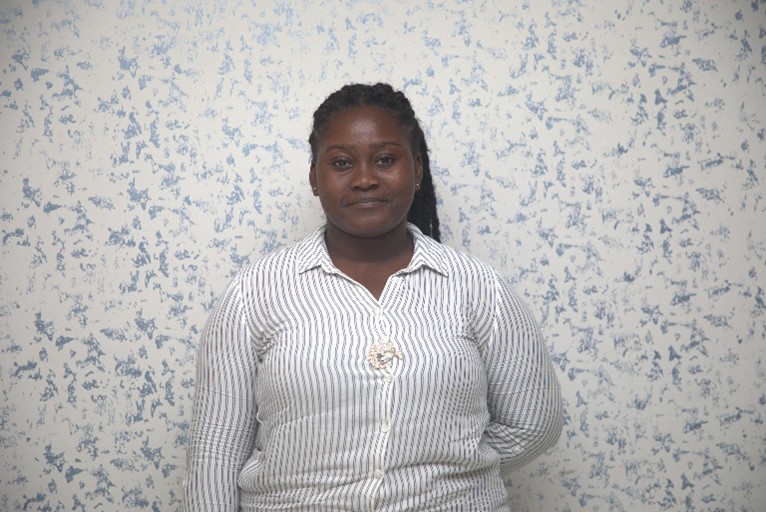
Afia Adu-Pako Dankwaa
Adu-Pako Afia Dankwaa is a final-year Geoscience undergraduate at KNUST. Her academic interests are centered on understanding Earth systems, with a particular focus on geoscience applications. She has gained research experience as a Research Administrator at the West Africa Geophysics Laboratory. She has held several leadership positions including Financial Secretary of Africa Hall and Deputy Academic Board Chair of the Student Representative Council.
Emmanuel Boahen
Undergraduate researcher at WAGeo Lab.
Faustina Awafu
Undergraduate researcher at WAGeo Lab.